

1. Introduction
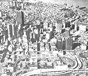
The San Francisco Bay Area is in the midst of a mobility crisis. This is clearly perceived by residents and public officials who have devised a variety of transportation programs to cope with it. The Bay Area Rapid Transit System (BART), the Metropolitan Transportation Commission, and the Golden Gate Bridge Highway and Transportation District are but a few examples. In spite of this, the crisis is intensifying in proportion to our ability to deal with it. The environmental hazards of the automobile, the energy shortfall, and the inexorable increase in population are placing greater and greater demands upon Bay Area transit systems. Equally significant, the mobility crisis is being experienced throughout California and is especially severe in the Los Angeles basin. Consequently, competition for scarce federal and state resources will make it increasingly difficult to rely upon outside assistance in the development of needed transportation projects.
The Transbay Transit Terminal Transportation Study describes a short-term, low-cost project which can improve the efficiency of regional transportation for a 15 to 20 year period. It is designed to provide some breathing space in which to solve the important institutional and financial problems related to the development of a comprehensive regional transportation system.
The project is unique, however, in that it did not begin as a transportation study, but rather as a land disposition project. For a long time it was widely held that when BART began transbay operations, AC Transit's transbay operations would be reduced to such a level that the Transbay Terminal would cease to operate as a commuter facility. When the California Toll Bridge Authority began a study to determine what could be done with the property, it no doubt anticipated that the outcome would be sale of the property and, ultimately, private development of the site. Although the early studies dealt extensively with alternative private uses of the property, the study process exposed a broad current of opinion, both professional and lay, that the terminal ought to retain a transportation function. Thus, the land disposition studies which evolved demonstrated that the property could be used both for private development and for public transportation facilities.
The notion that the terminal should continue to play a transportation role gained official status through the adoption of a development concept and strategy by the California Toll Bridge Authority and a resolution by the San Francisco Board of Supervisors. The notion gained widespread acceptance by the public and the press. In fact, the seemingly intuitive acceptance of the retention of a transportation facility has been so widespread that during the course of numerous public meetings and presentations the idea has rarely, if ever, been challenged.
This study, then, is unique. It started out to reaffirm public opinion. It concluded that a new, expanded regional transportation terminal can, indeed, play an extremely important role in Bay Area transportation in the immediate future.
Three basic transportation corridors serve San Francisco: East Bay, Marin, and Peninsula (see Figure 1 ). Today the Transbay Terminal serves the East Bay area primarily. This study suggests improving the terminal and the approach ramps in order to provide service to both Marin and Peninsula travelers.
This report provides a summary of the work undertaken by Barton-Aschman Associates, Inc., and the California Department of Transportation to analyze travel in the Bay Area and forecast future travel. To make these forecasts, a mathematical model developed for the West Bay Network Study was used. The West Bay Network Study is a subregional traffic study covering the Counties of San Francisco, San Mateo, and the northern half of Santa Clara County. The model was developed in 1973 by the California Department of Transportation. Originally, the intention was to utilize the Regional Transit Travel Projection Project Model which is currently under development; however, time constraints and unavailability of this model precluded its use. The West Bay Model projects travel demands for the year 1995; it does not provide a profile of demand by specific mode (auto, transit). A general modal split (identification of trips made by auto or transit) was derived from previously published data obtained in the Bay Area Transportation Study. A detailed modal split for each of the three major travel corridors to San Francisco was made from data on travel characteristics in the area.